
Lukasz Warzecha/Westsweden.com
Krokstrand - Högstad
- Length
- 13 km
- Degree of difficulty
- Red
- Estimated time
- 5–6h
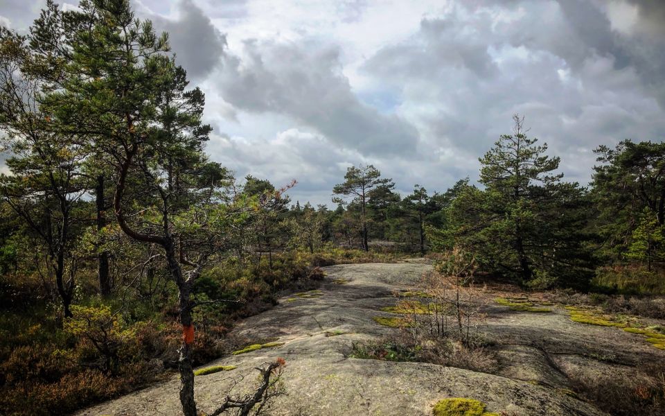
Bohusleden's highest and northernmost tip. Up and down. Forest and bare rocky outcrops. Forest roads and farms. A beautiful and contrasting stage.
The 26thsection of the Bohusleden Trail runs between Krokstrand and Högstad, in the District of Strömstad.
The Trail starts in the small community of Krokstrand and carries on across the impressive Löveråsfjället. Here it really is steep, all the way to the top of Björnerödpiggen. The Bohusleden Trail goes neither higher nor further north than this point.
Björnerödspiggen is the highest mountain in Bohuslän, at 222 metres above sea level. An impressive Bronze Age cairn marks the summit. At Björnerödspiggen there is a hut/shelter, a barbequing area and a viewing tower. The view from the tower is seriously impressive and on a clear day, stretches many tens of kilometres into Norway.
The Bohusleden Trail turns here and carries on down the mountain again following a path in a southwesterly direction. Small roads and paths eventually take you to Högstad, via the interesting archaeological remains at Jörlov-Masslebergdalen.
In Jörlov, close to the Bohusleden Trail, there are many rock carvings from the Bronze Age (800 BC - 500 BC). The largest rock carvings contain 160 different figures. At Massleberg there is a five thousand year-old grave, a so-called Chamber Tumulus, from the Stone Age. People have clearly lived and worked here for thousands of years.
Surface: This section is mainly on dirt road and forest path, but also a little on asphalt.
Time: It takes approximately 5-6 hours to hike this section.
Not to be missed: A stop at the top of Björnerödspiggen.
How to get here: In Krokstrand there are a couple of bus stops close to the trail with buses on a quite regular basis, Skog, Krokstrand and Björneröd. 500 meter från Höstad there is also a but stop called Högstad. For more information, please see the map planning tool.
Accommodation: There are no suggested places for accommodation along this section, but it might be possible to find accommodation in Krokstrand via Air BNB
13 km
Degree of difficulty
About Difficulty Grading
The grading is tailored for Swedish lowland trails that adhere to the quality criteria established by the national framework for hiking trails.
Even and firm ground: The terrain is generally flat. The hike requires no need to use your hands for support. No obstacles. Bridges are always present when crossing waterways.
Uneven and/or soft ground: Some changes in elevation. Certain sections may require hand support to maintain balance. There may be obstacles such as low stiles and short stairs. Minor obstacles like stones and roots. Boardwalks are present.
Loose or slippery ground combined with steep sections: Technical parts require hand support. There may be obstacles such as high stiles and longer stairs. Frequent sections with stones and/or roots. Boardwalks with deeper surrounding water.
Note: One or more of these features may be present along the trail section.
Red
5–6h
- Historia
- Skog
- Utsikt
- Vindskydd
- Vandringsled
- Bohusleden
- Utsikt
- Skog
- Vindskydd
- Vandringsled
- Historia
- Bohusleden
- Utsikt
- Skog
- Vindskydd
- Vandringsled
- Historia
- Bohusleden
- Utsikt
- Skog
- Vindskydd
- Vandringsled
- Historia
- Bohusleden
- Utsikt
- Skog
- Vindskydd
- Vandringsled
- Historia
- Bohusleden
- Utsikt
- Skog
- Vindskydd
- Vandringsled
- Historia
- Bohusleden
- Utsikt
- Skog
- Vindskydd
- Vandringsled
- Historia
- Bohusleden
- Utsikt
- Skog
- Vindskydd
- Vandringsled
- Historia
- Bohusleden
- Utsikt
- Skog
- Vindskydd
- Vandringsled
- Historia
- Bohusleden
- Utsikt
- Skog
- Vindskydd
- Vandringsled
- Historia
- Bohusleden
- Utsikt
- Skog
- Vindskydd
- Vandringsled
- Historia
- Bohusleden
- Utsikt
- Skog
- Vindskydd
- Vandringsled
- Historia
- Bohusleden
- Utsikt
- Skog
- Vindskydd
- Vandringsled
- Historia
- Bohusleden
- Utsikt
- Skog
- Vindskydd
- Vandringsled
- Historia
- Bohusleden
- Utsikt
- Skog
- Vindskydd
- Vandringsled
- Historia
- Bohusleden
- Utsikt
- Skog
- Vindskydd
- Vandringsled
- Historia
- Bohusleden
- Utsikt
- Skog
- Vindskydd
- Vandringsled
- Historia
- Bohusleden
Highlights along the section
Here are some places that are frequently visited and appreciated by others.